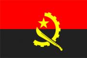
Angola is situated on the Western coast of Southern Africa at the geographic co-ordinates of 12 30 S, 18 30 E and was a Portuguese colony until 11 November 1975, when acquired its independence.
 It has an area of 1,246,700 Sq Kilometers and it shares its borders of 4,837 km with the Republic of Congo (Brazzaville) and the Democratic Republic of the Congo (ex-Zaire) in the North, Zambia to the East and Namibia in the South. The West is washed by the Atlantic Ocean and this coastline is 1,650 kilometers long.
The highest peak is Monte Moco (2,620 meters), situated in Huambo and the rivers Kwanza, Zaire, and Cunene, Cubango e Bengo, cross Angola.
The currency is Kwanza (Kz).
It is divided into 18 provinces, and its capital city is Luanda. The main maritime ports are in Luanda, Lobito, and Namibe.
The estimated number of inhabitants in 2014 was 24,3 million.
It was also estimated in 1995 that the population was distributed as follows: 48% (males) 52% (females). Out of that, 32% lived in urban areas and 53% being economically active.
Luanda has 6,5 million people.
Angola's official language is Portuguese, but the country counts with various dialects such as Kikongo, Kimbundo, Umbundu, Chokwe, Mbunda and Oxikwanyama.
The population is predominantly Christian; with the Catholic religion being the most expanded one.
It has a tropical climate with two seasons: semi-arid from May to September and hot and rainy from September to May.
The terrain is a narrow coastal plain, which rises abruptly to a vast interior plateau
The natural resources are oil, diamonds, iron ore, phosphates, copper, feldspar, gold, bauxite, and uranium. The land has excellent conditions for plantation and pastures. It also has a vast area of forests and woodland providing wood and other materials


